BRICKWORKS & POTTERIES OF THE IPSWICH (Qld) REGION
Alister J Cameron
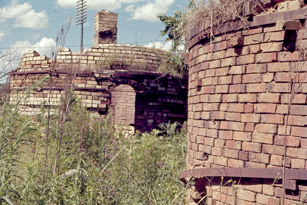
Yamanto Brick Kiln
I know very little about this brickworks, in particular; what it was called.
I would welcome further information
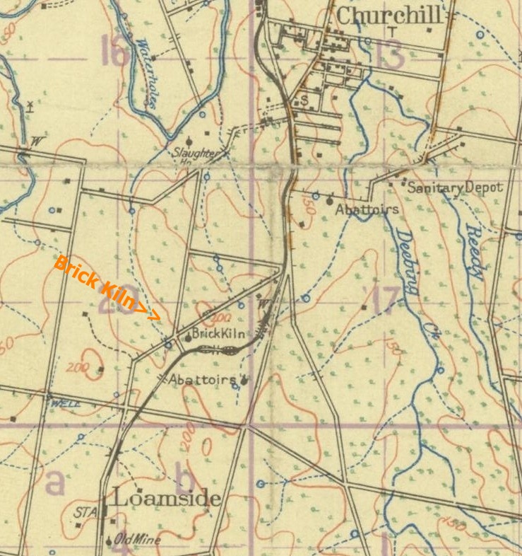
1928 TOPOGRAPHICAL MAP OF KILN AREA
The Fassifern Branch runs from north to south throughout the area.
Source: Qld State Archives.
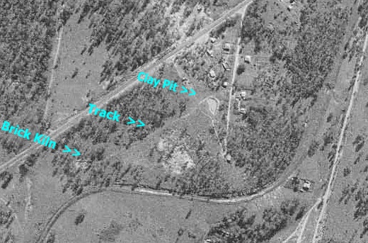
AREA PHOTO OF BRICKWORKS AREA 1958
A track between the likely clay pit and Kiln site can clearly be seen.
Photo source: QImagery.
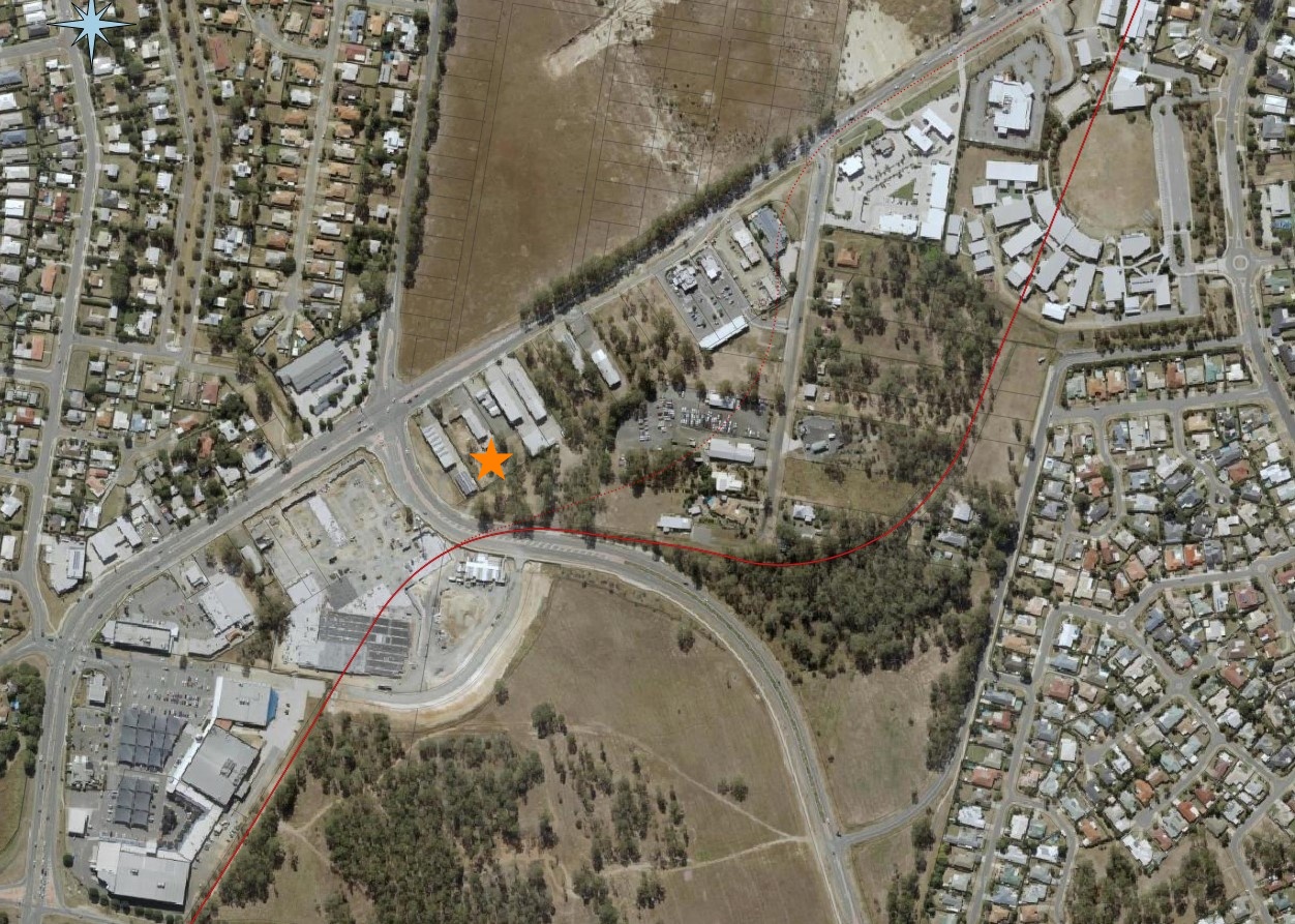
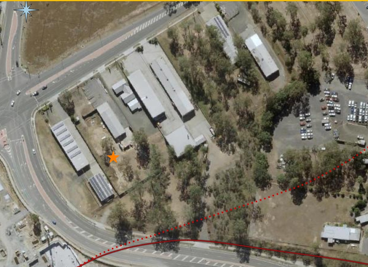
SAME AREA FROM ABOVE, THE PRESENT DAY.
The star shows where the map says the kiln was located.
To the right is the curve of railway line called the "Cape Horn Deviation".
Underlay: Qld Globe (Ausmap).
Overlay: QGIS Vectors (Alister J Cameron)
CLOSE-UP OF THE SITE.
The dotted line represents the original trajectory of the railway line before deviation. Probably long gone by the time the kiln was erected.
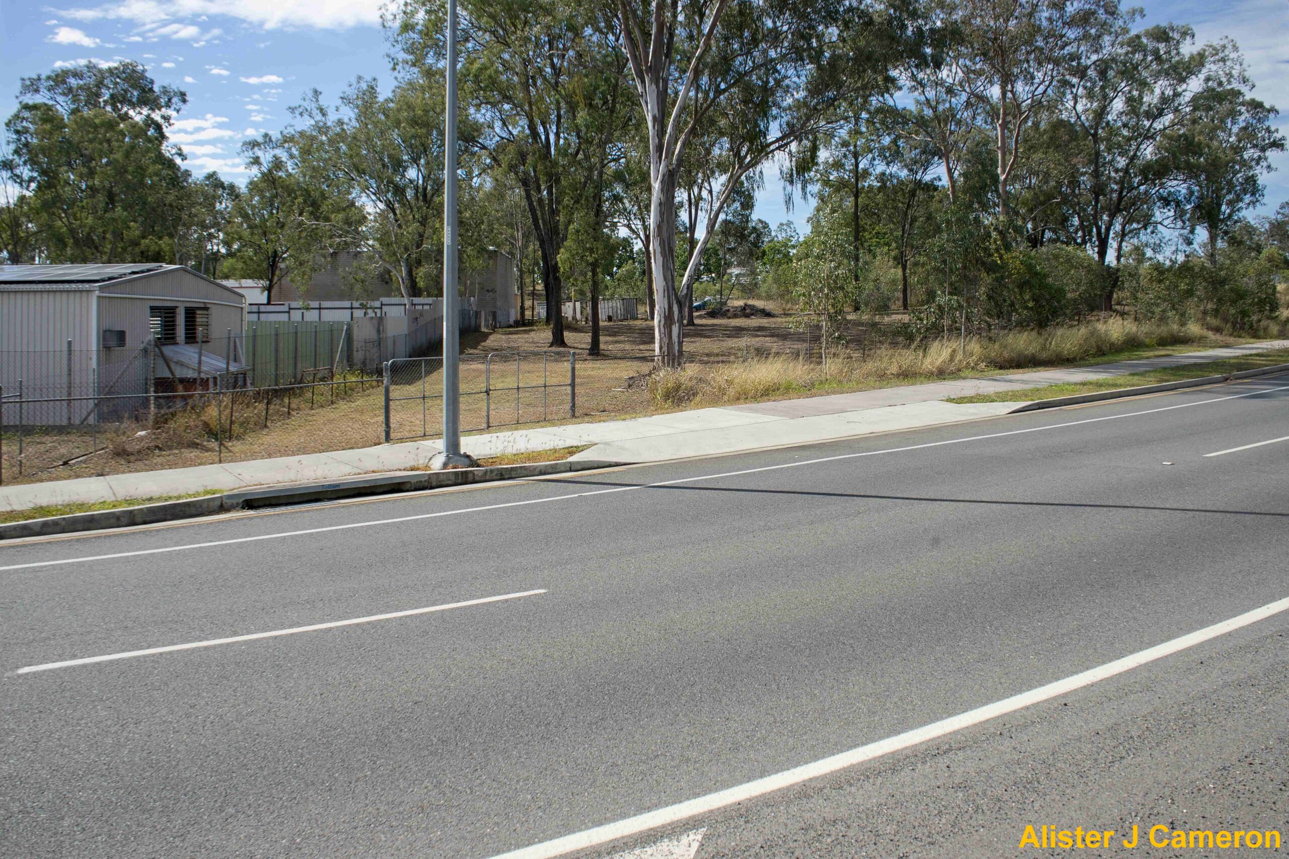
SITE OF KILN IN 2019
The approximate area includes the rear of the businesses on the left, the fenced off area on the right and probably part of the road easement at the front.
Photo: Alister J. Cameron
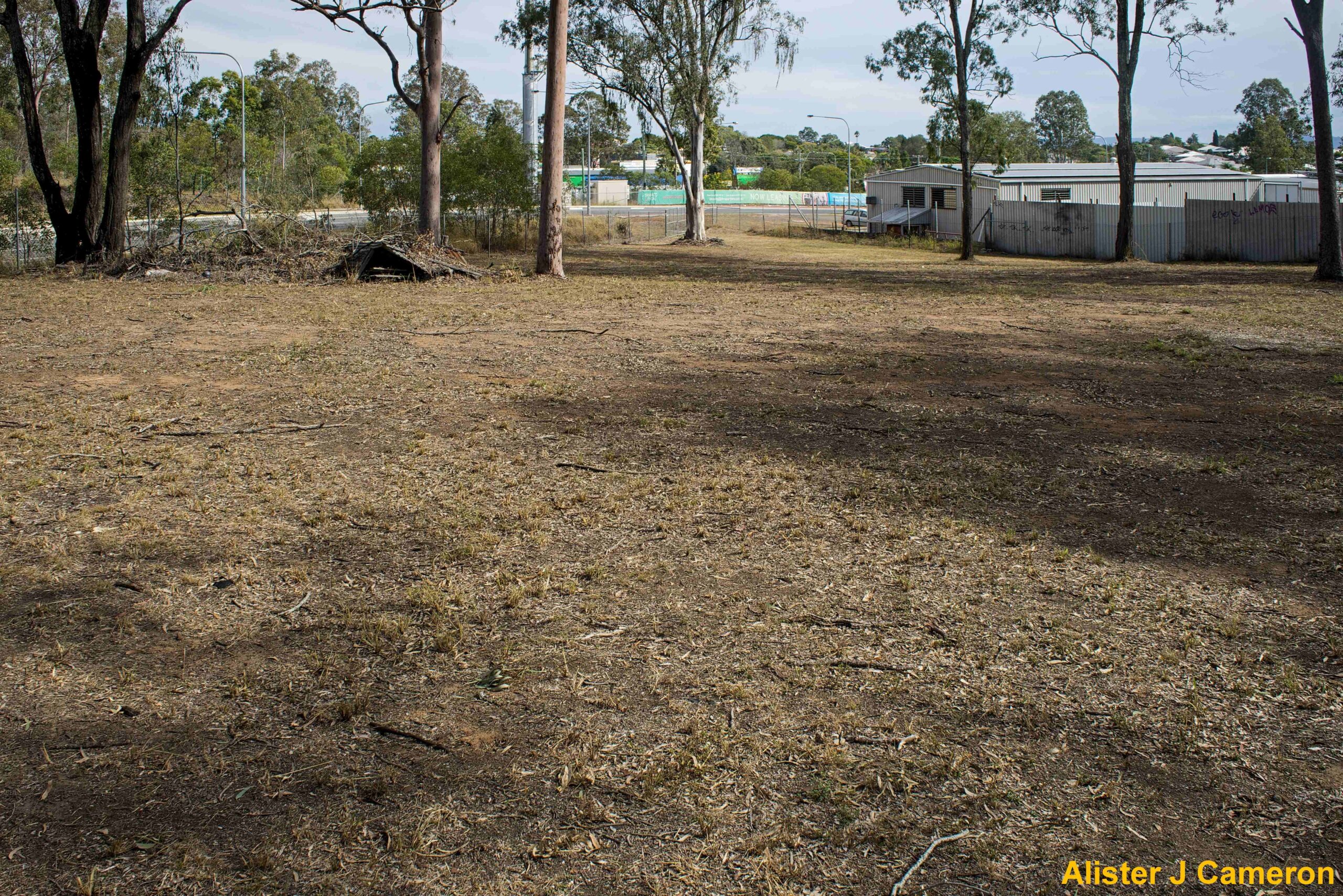
THE SITE VIEWED FROM THE OPPOSITE DIRECTION The land in front of the buildings has been entirely cleared of any evidence of the brickworks.
Bricks
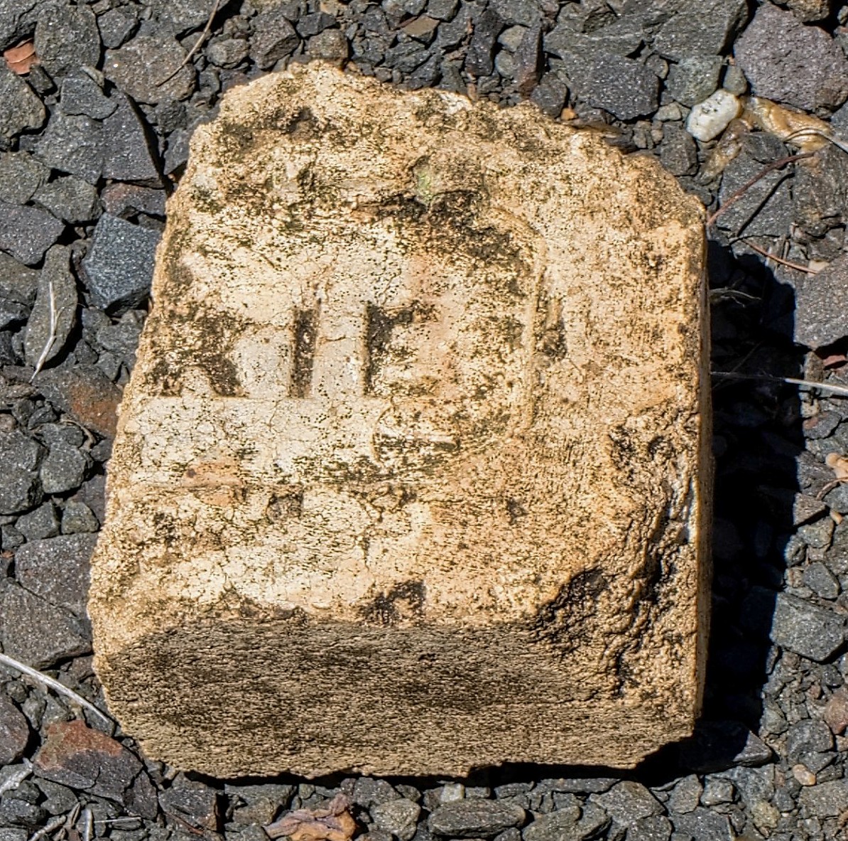
BRICK FRAGMENT WHICH I FOUND ON THE SITE 2019
I haven't been able to match the frog with any others in my collection.
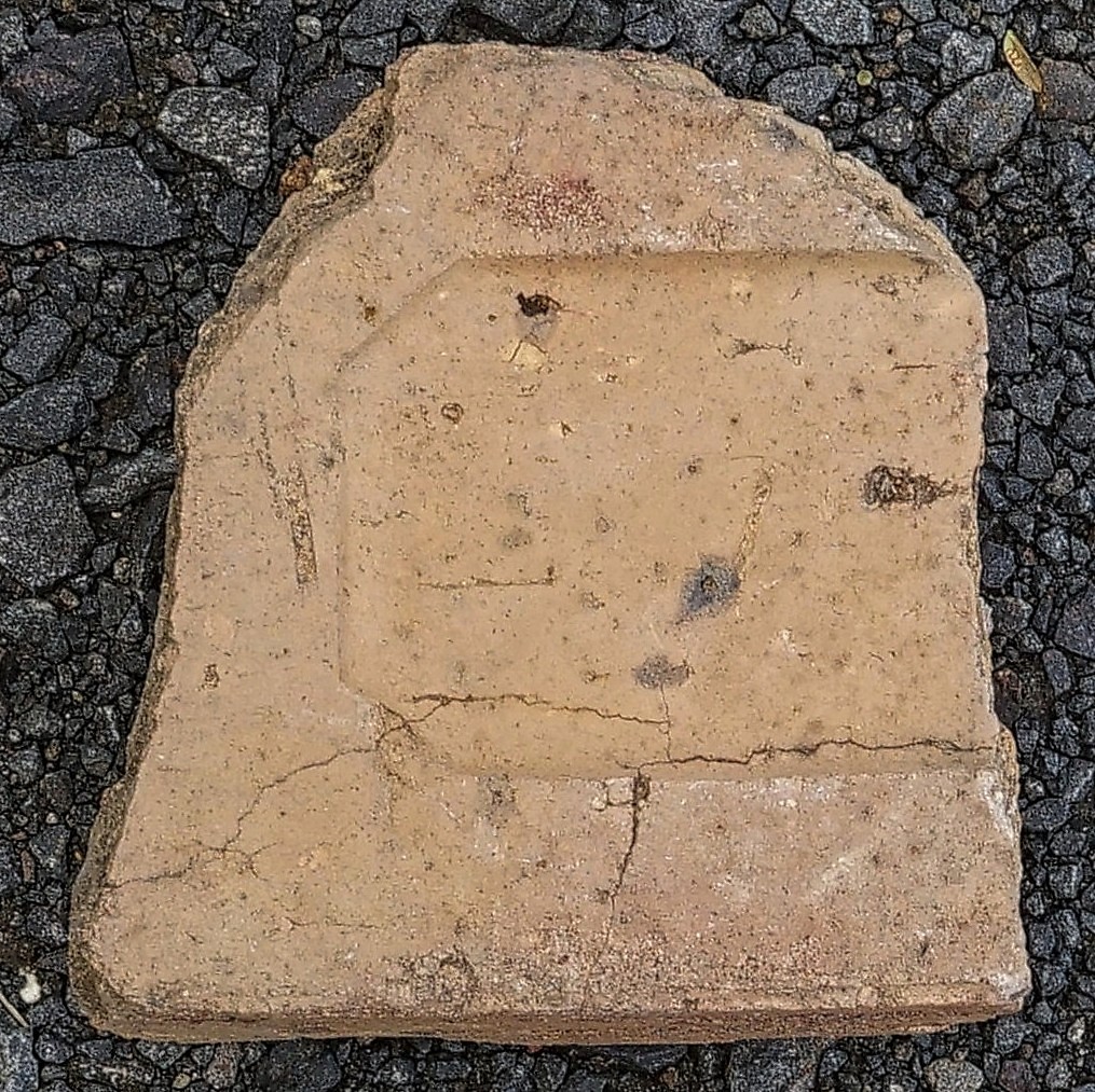
ANOTHER BRICK FRAGMENT FOUND AT THE SITE 2022
It is a Petrie kiln brick (John Petrie) and probably would have been imported from Brisbane to build the kiln.
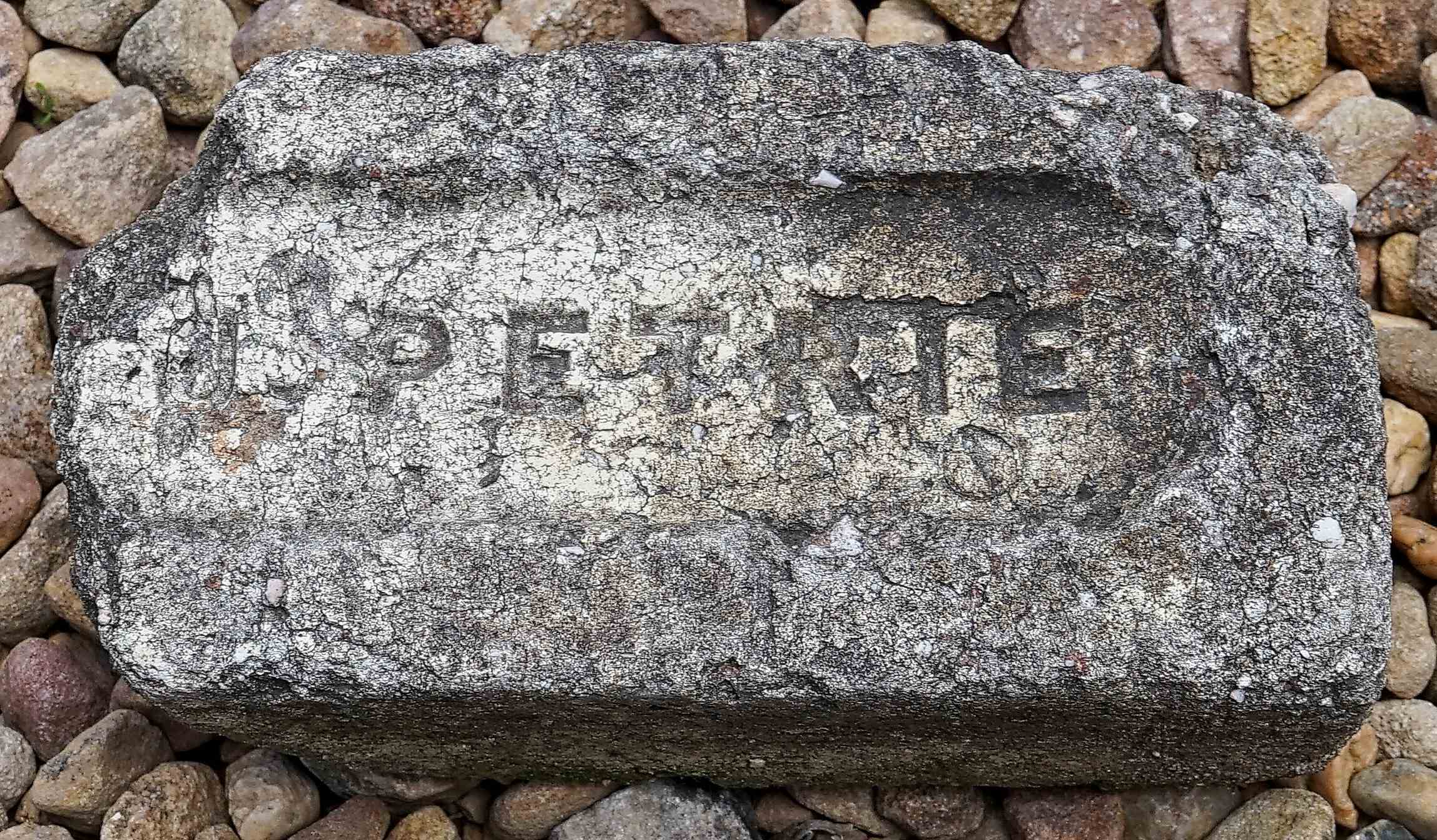
AS AN EXAMPLE, ABOVE IS A MORE COMPLETE PETRIE BRICK FOUND ELSEWHERE IN THE IPSWICH REGION. From my collection.