BRICKWORKS & POTTERIES OF THE IPSWICH (Qld) REGION
Alister J Cameron
John (Jack) Wright
Period of Brick-Making: c1850s — c1860s
Brick-makers Employed By Wright:
Thomas Welldon, Harry Wheeler, Harry Crosby, Stonebridge, Thomas Lovegrove
Supervised Brick-making For:
St Paul’s Anglican Church, Sovereign Hotel, One-Mile Hotel, Ipswich Hotel, Old Court House
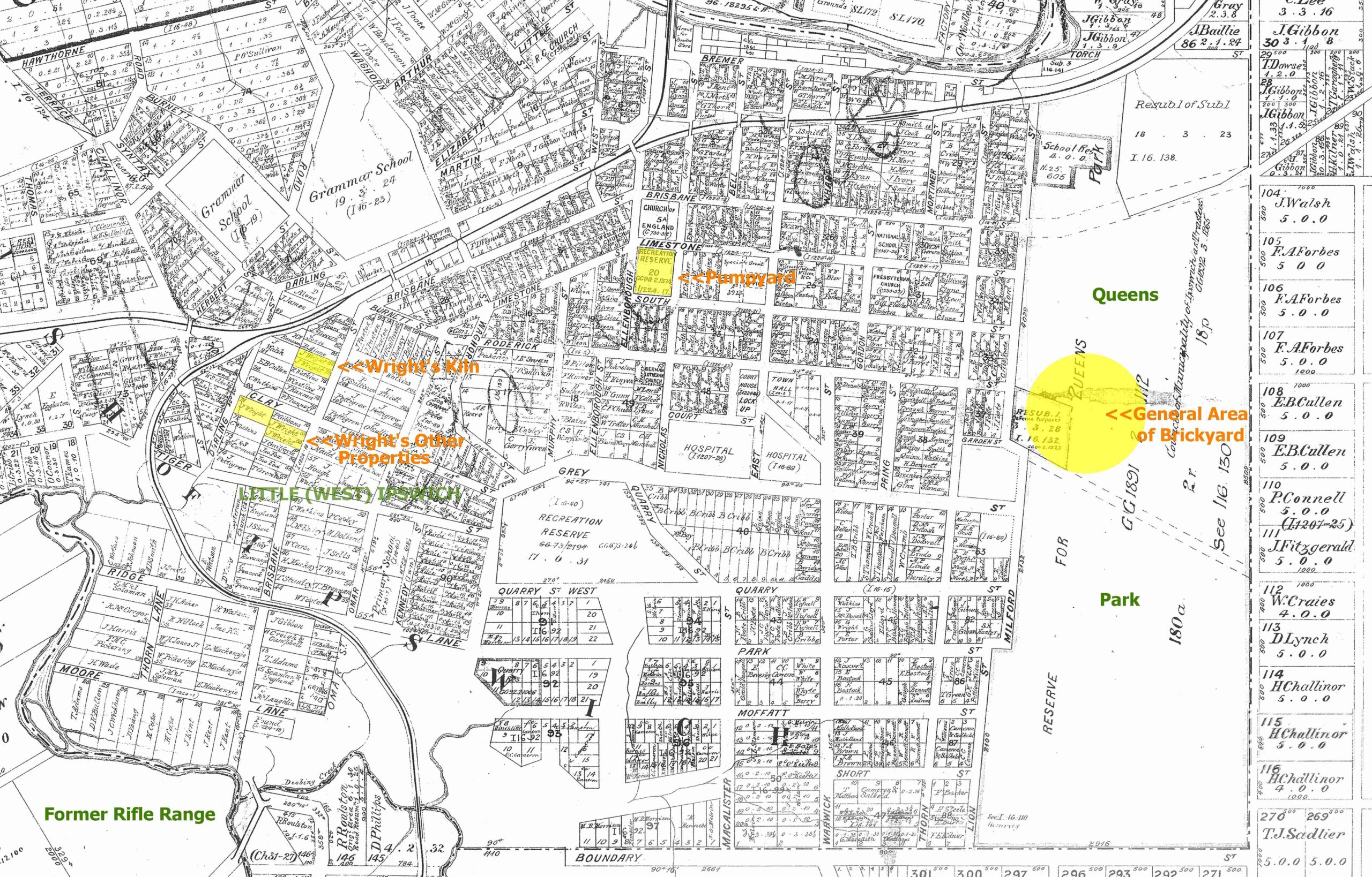
Location of Wright's Brickyards
VARIOUS PLACES AROUND IPSWICH WHERE WRIGHT HAD BRICKYARDS
Wright might also have had further brickyards in West Ipswich as yet not identified.
Source: 1880s cadastral map scanned at Ipswich Council Library; Alister J Cameron
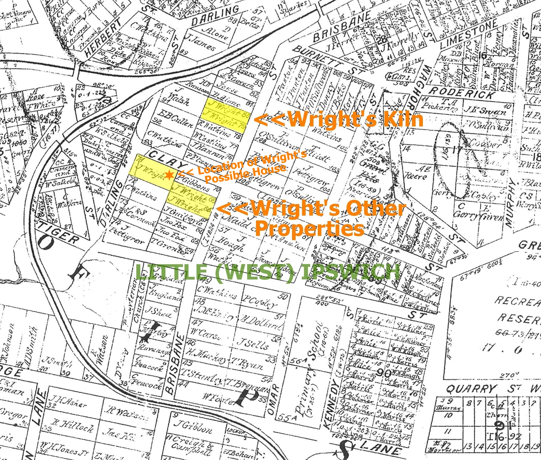
CLOSEUP OF WRIGHT'S PROPERTIES IN WEST IPSWICH
The star shows location of what was possibly Wright's house.
Source: 1880s cadastral map scanned at Ipswich Council Library; Alister J Cameron
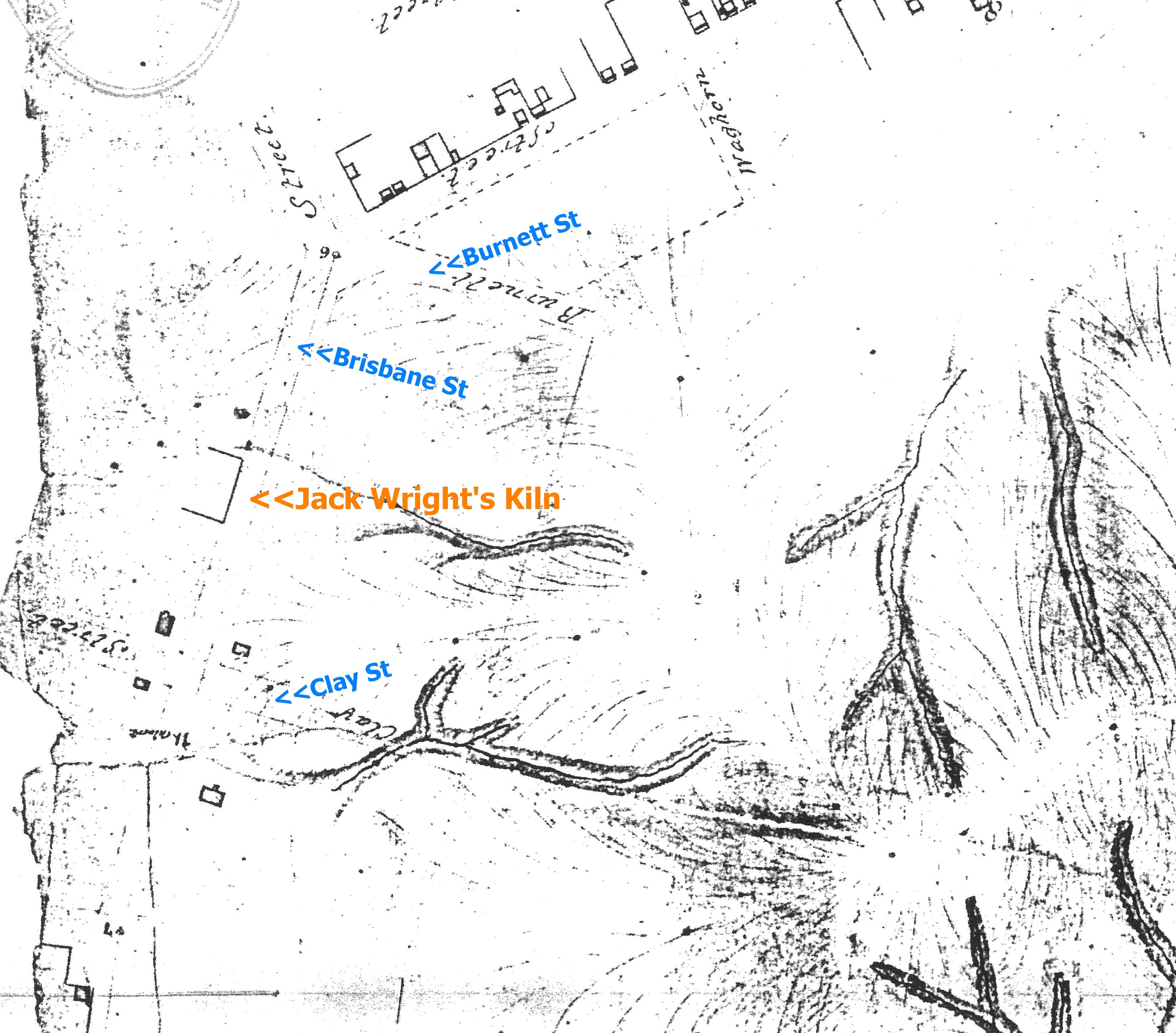
1857 TOPOGRAPHICAL MAP OF WRIGHT'S WEST IPSWICH KILN
Scanned at Ipswich Council Library; Alister J Cameron
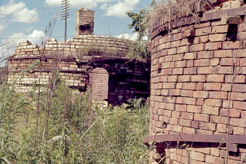
1946 AERIAL PHOTO OF WRIGHT'S FORMER PROPERTIES
The kiln site shows evidence of a gully at the rear.
Gogg's Terrace was a rare example of terrace housing in the Ipswich area. It has long since been demolished.
Source: QImagery
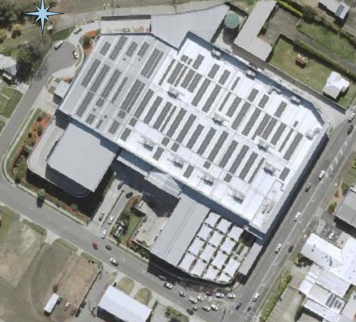
2025 AERIAL PHOTO WRIGHT'S KILN SITE
It's now dominated by a large Bunnings complex.
Source: Qld Globe (Ausmap)
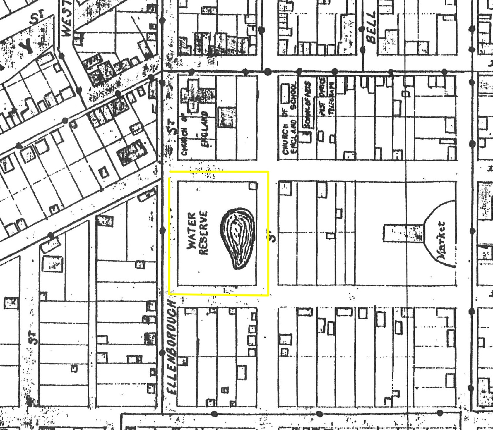
OLD PUMP YARD (WATER RESERVE) 1877
Cadastral map scanned at Ipswich Council Library; Alister J Cameron
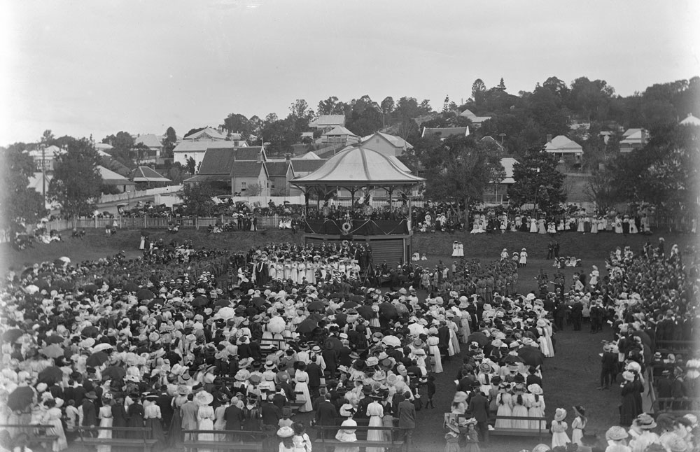
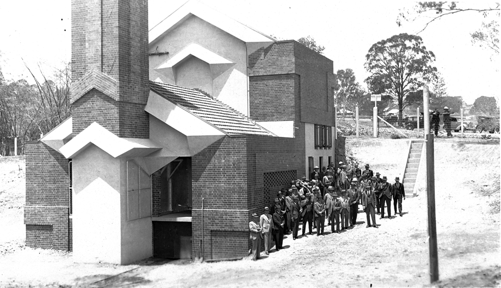
FORMER PUMP YARD SITE IN 1910
At this point in time it was the 'Central Gardens' and a crowd is pictured attending the funeral service for King Edward VII. Later the Soldiers Memorial Hall and Technical College were built here.
Source: Picture Ipswich Reference ID WHD-005-gpl-0203p.jpg
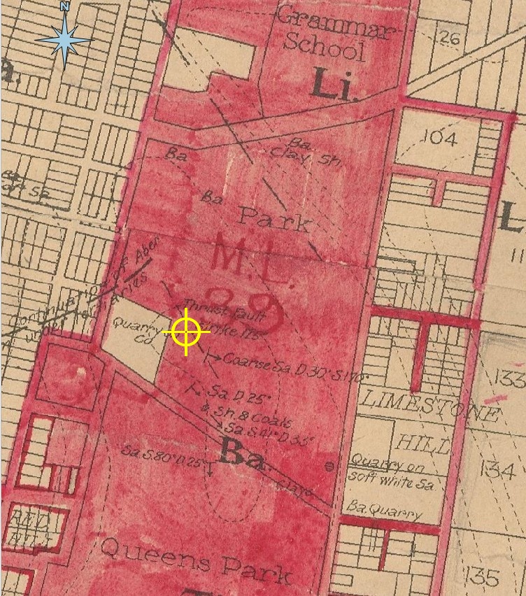
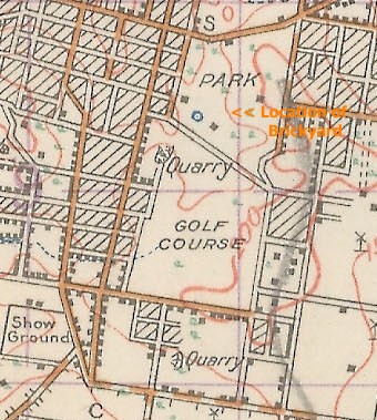
1886 CADASTRAL MAP OF THE LOCATION OF THE QUEEN'S PARK BRICKFIELD
Yellow symbol marks the approximate area
The red overlay was added at a later time.
Source: https://geoscience.data.qld.gov.au/map-collection/mr010634
SITE OF QUEEN'S PARK BRICKFIELD IN 1928 BEFORE THE CONSTRUCTION OF THE GRIFFIN INCINERATOR
Note the small waterhole which could either be a former clay pit or water source for the works.
Source:
https://gisservices.information.qld.gov.au/
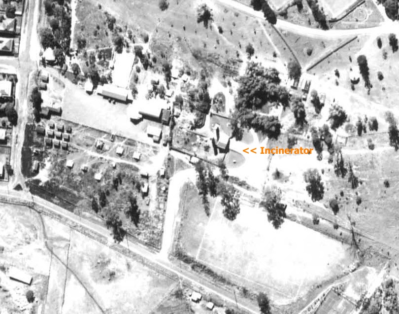
1946 AERIAL PHOTO OF A SECTION OF QUEEN'S PARK
The incinerator was constructed on the former brickyard site.
Source: QImagery
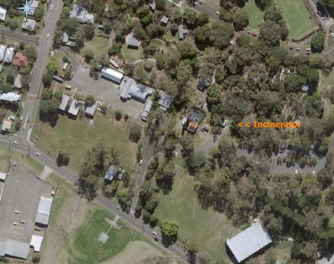
THE SITE FROM ABOVE IN 2025
The incinerator has now been converted to a theatre.
Source: Qld Globe (Ausmap)
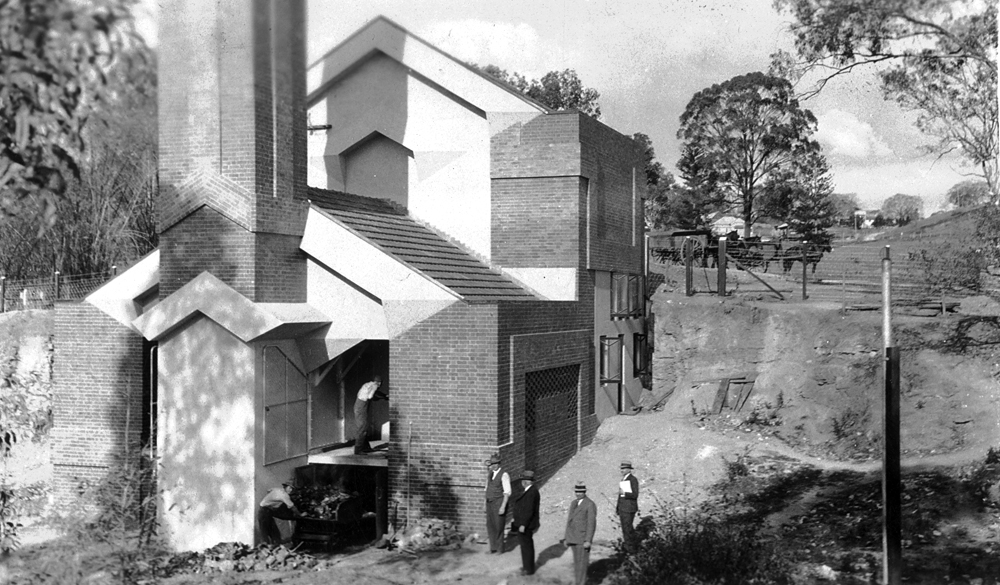
REAR VIEW OF INCINERATOR IN 1936 AFTER COMPLETION BUT BEFORE SITE HAD BEEN CLEANED.
Raises question as to whether it was constructed making use of the former brickyard workings.
Source: Picture Ipswich Reference ID
qips-2009-06-03-0010p.jpg
BY THE TIME OF THE OFFICIAL OPENING IN 1936 THE WHOLE SITE HAS BEEN CLEANED UP.
Source: Picture Ipswich Reference ID
qips-2009-06-03-0008
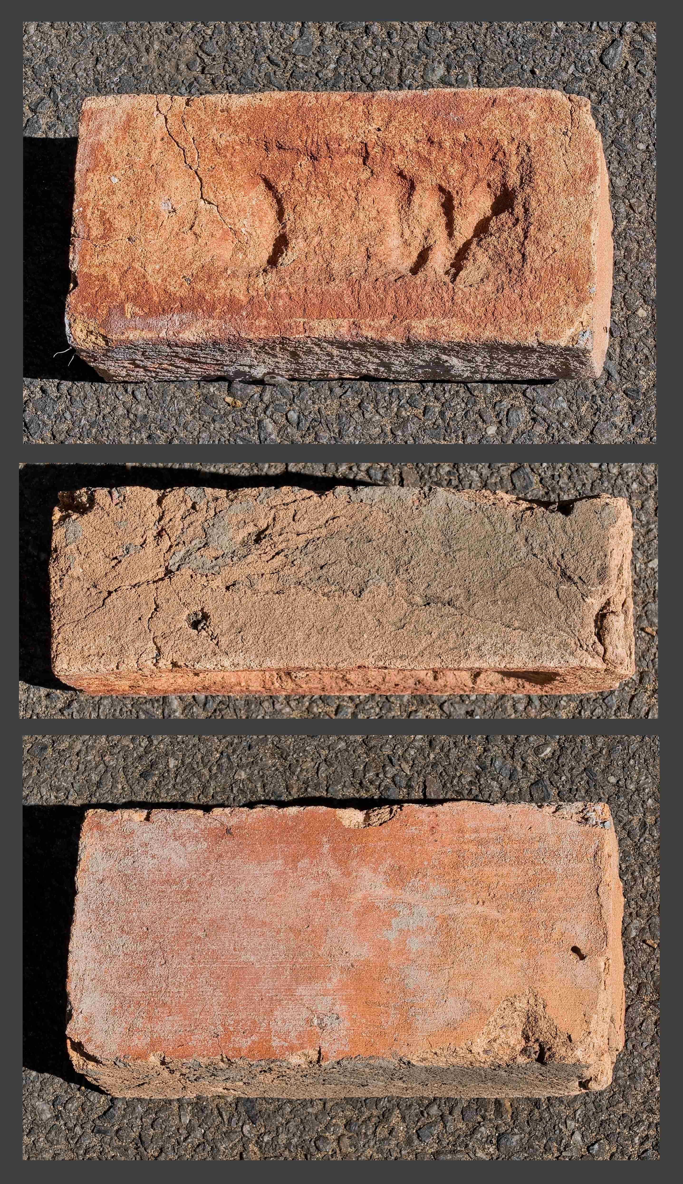
Bricks
Description: Red, sandy brick. Condition: Extremely crumbled. Type: House Brick Frog: Large, shallow frog. Inscription: “J W” (indented). Origin: River bank below Hancock’s Sawmill site. Current Location: My Collection.
Description: Orange, sandy brick. Uneven side edges. Condition: Very crumbled. Type: House Brick. Frog: Large, shallow frog with inscription. Flat on rear. Inscription: “J W” (indented). Origin: Unknown. Current Location: Ipswich Historical Society Collection.
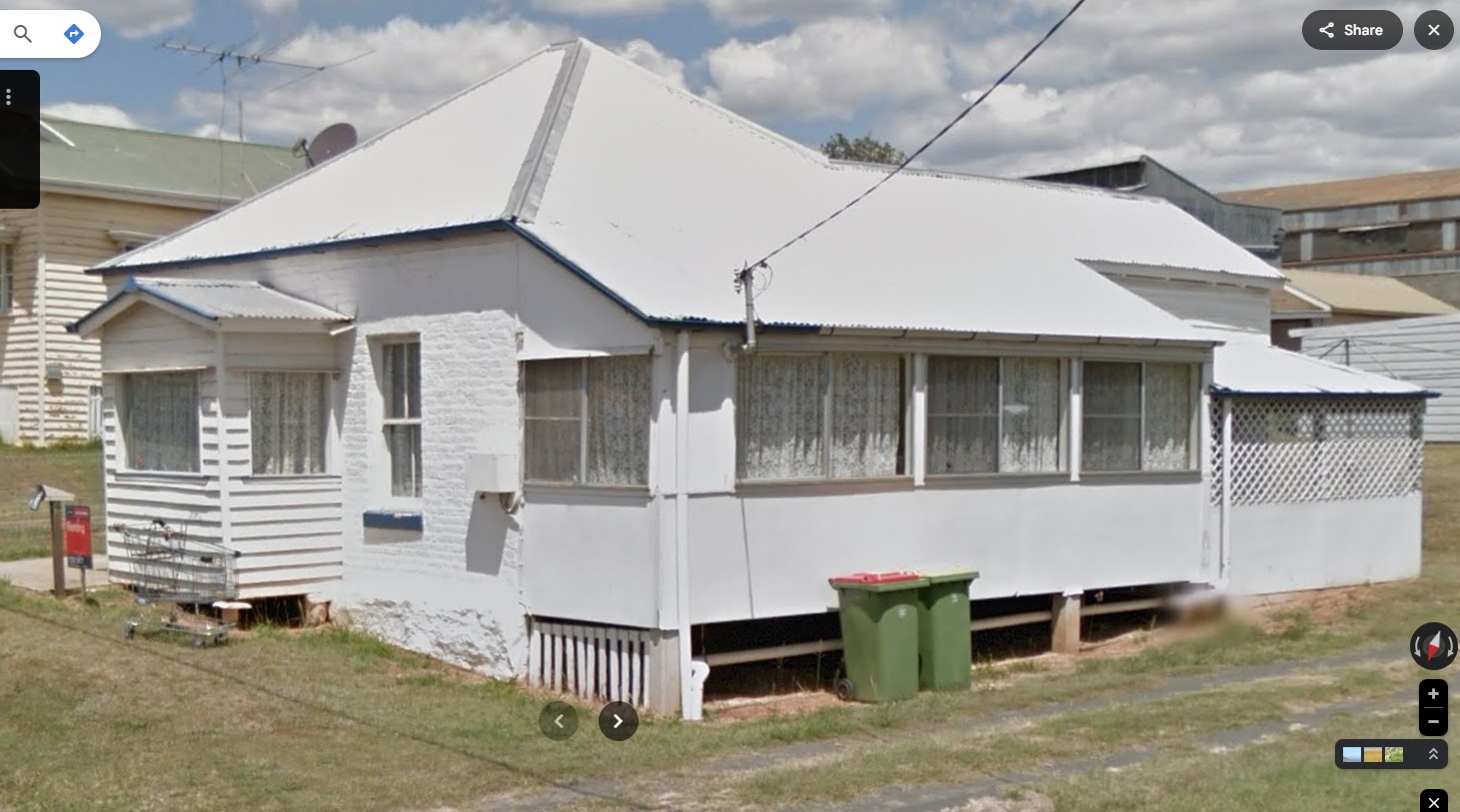
Wright's Possible House
HOUSE POSSIBLY BUILT BY WRIGHT: VIEWED IN 2014
The main house is brick, but it includes later additions and possibly a change in roof line.
Source: Google Street View
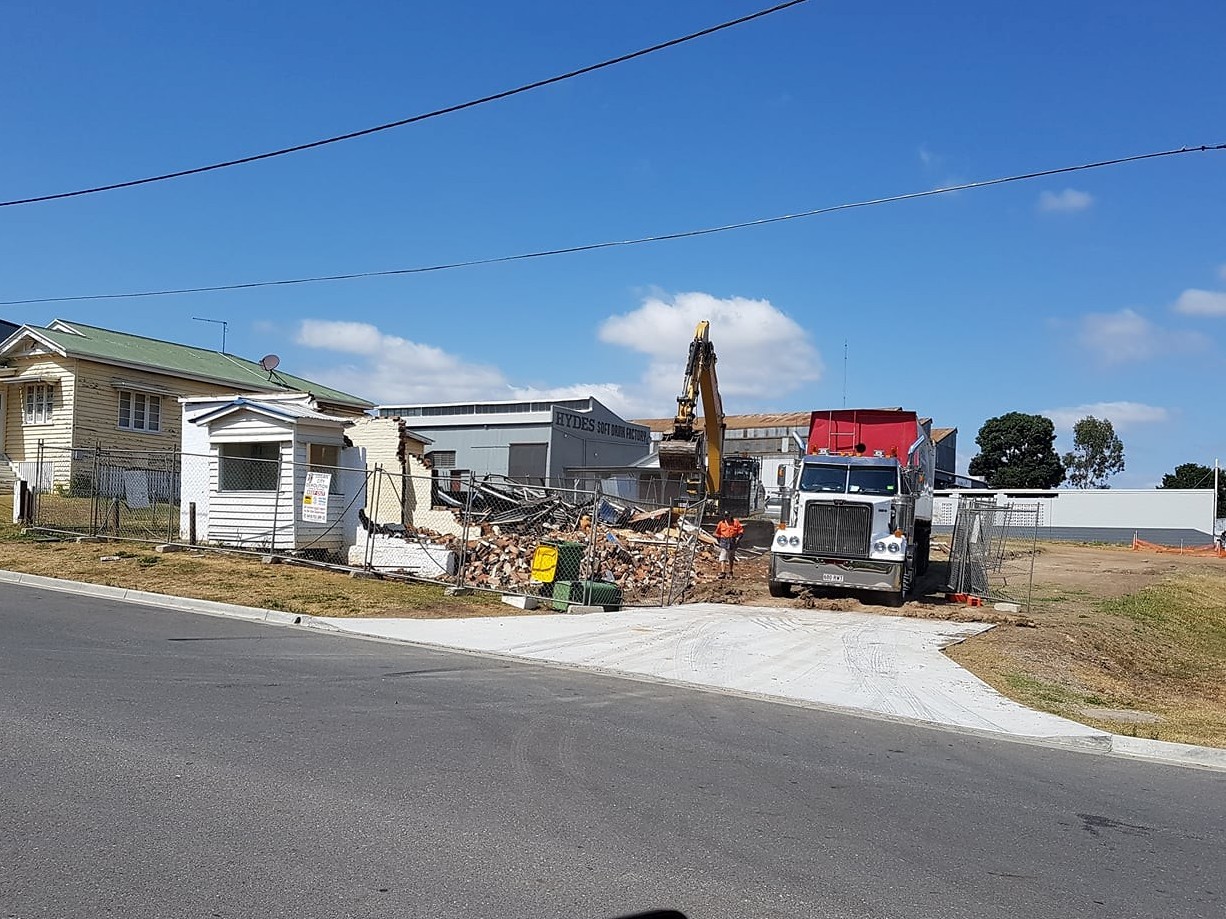
SUBSEQUENT DEMOLITION OF THE HOUSE.
Unfortunately the site has been completely redeveloped and nothing remains of what was there previously.